For the upcoming exercise, we will work with the gruental.gpkg. data set: Import it into R.
You may have noticed the following warning message when importing the gruental.gpkg geopackage:
Warning message:
In evalq((function (..., call. = TRUE, immediate. = FALSE, noBreaks. = FALSE,  :
  automatically selected the first layer in a data source containing more than one.
This warning message indicates that the geopackage gruental.gpkg has several layers (rep. records) and only the first layer has been imported. Use the st_layers command to find out the layer names and then use them in st_read (as argument layer =) to import the layers individually and store them in variables (e.g., such as in the variables wiesen and baeume).
Take some time to explore the two datasets. Use the visualisation options of ggplot (especially geom_sf). You can superimpose multiple geom_sf to represent multiple records at the same time.
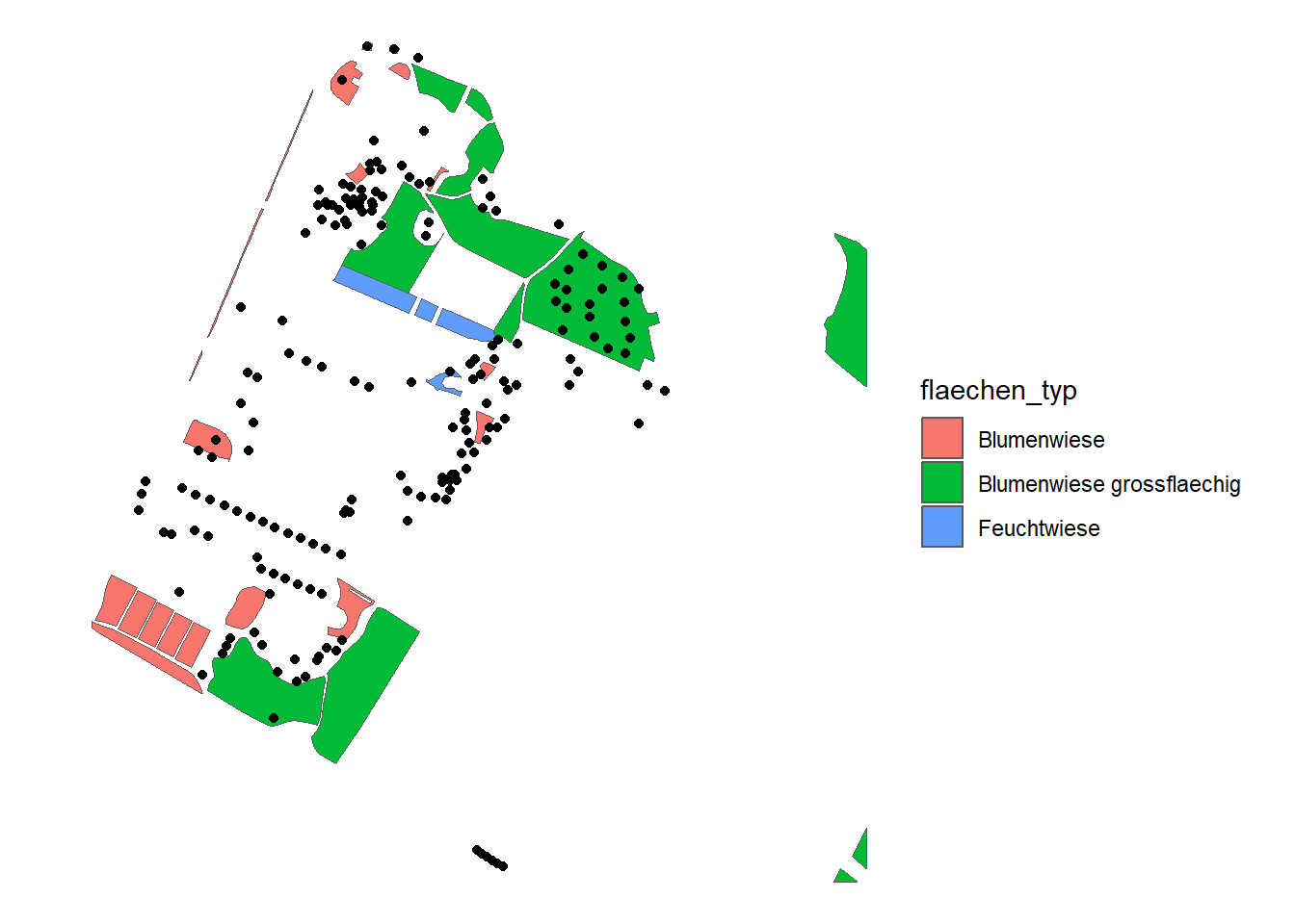
Figure 20.1: Meadow areas are shown in different colours depending on type
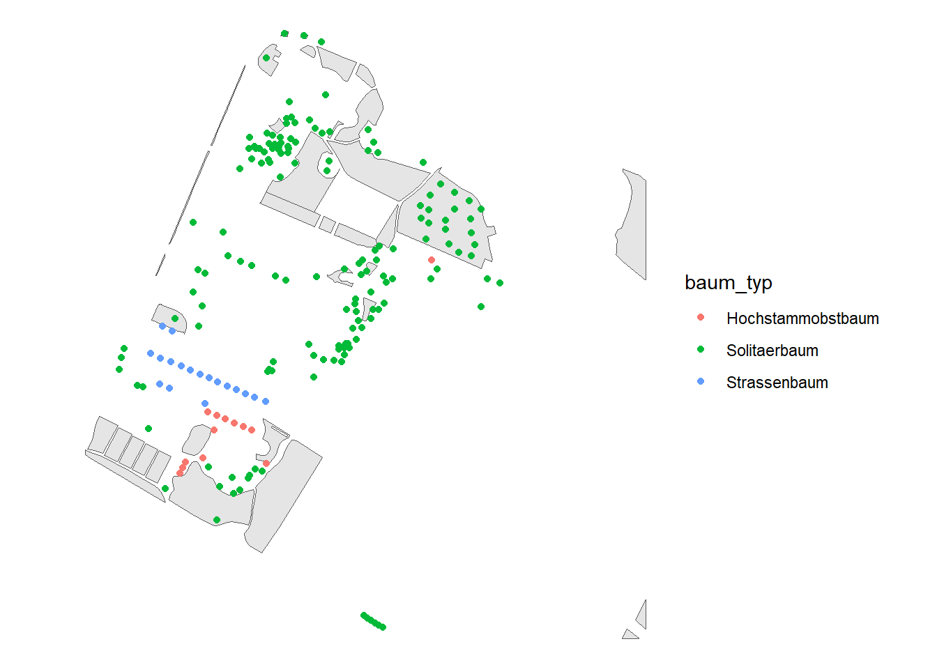
Figure 20.2: Trees are shown in different colours depending on type
Task 3: Spatial join with points
We now want to know whether each tree is in a meadow or not. To do this, we use the GIS technique spatial join as described in the lecture. Using sf, we can perform spatial joins with st_join. There are only left and innerjoins (see PrePro 1 & 2). The points must be listed first, since we want to attach attributes to the points.
Note that the output has a new column: flaechen_typ. This is empty (NA) if the corresponding tree is not in a meadow. How many trees are in a meadow and how many are not?